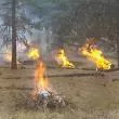
Firefighters across the Deschutes National Forest plan to begin pile burning as conditions are favorable. Firefighters select pile burning units for ignition based on moisture levels, forecasted weather and conditions predicted to move smoke away from communities where possible. Firefighters primarily plan to start with higher elevation piles moving to lower elevations as additional precipitation occurs. Ignitions could begin as soon as Wednesday and last through early 2025.
The Bend-Fort Rock Ranger District plans to implement pile burning on up to approximately 5,000 acres in various locations, including west of Bend, east of Edison Butte, west of Sunriver, along the Cascade Lakes Highway, north of Tumalo Creek and southeast of La Pine. Ignitions may begin as early as Thursday.
The Crescent Ranger District plans to conduct pile burning on up to approximately 2,500 acres and is slated to start burning as soon as Wednesday. Pile burning is slated for various locations, including along Forest Service Road 60 north of Windigo Pass, in the vicinity of Bunny Butte, east of Highway 97 and south of Little Walker Mountain, south of Crescent, and east of Davis Mountain.
The Sisters Ranger District plans to implement pile burning on up to approximately 500 acres in a variety of locations, including south of Sisters near Forest Service Road 16, the Green Ridge area northeast of Sisters, and areas around the Metolius Basin. Ignitions are slated to begin early next week if conditions are favorable.
Piles may smolder, burn, and produce smoke for several days after ignition. Once ignited, firefighters monitor piles until they are declared out. Please do not report ignitions.
While smoke may linger in the area, removing these large accumulations of woody debris during the winter months minimizes fire danger. The piles are concentrations of leftover materials associated with vegetation management activities being done to help maintain and restore forest and ecosystem health while reducing hazardous fuels loading.
What does this mean for you?
Smoke may settle in low-lying areas overnight and in the early morning hours.
- All residents are encouraged to close doors and windows at night to avoid smoke impacts.
- If available, use a portable air cleaner. Air cleaners work best running with doors and windows closed. You can also create a DIY air cleaner.
- If you have a central air system, use it to filter air. Use high-efficiency filters if possible.
- When driving in smoky areas, drivers should slow down, turn on headlights and turn air to recirculating.
- If you have heart or lung disease, asthma, or other chronic conditions, pay attention to how you feel and if symptoms of heart or lung disease worsen, consider contacting your health care professional.
- Go to centraloregonfire.org to learn more about smoke safety and prescribed burning in Central Oregon and visit When Smoke is in the Air for more smoke preparedness resources.
For more information visit centraloregonfire.org/ or fs.usda.gov/deschutes and follow us on Twitter @CentralORFire. Text COFIRE to 888-777 to receive prescribed fire text alerts.
This work is occurring within the Central Oregon Landscape, one of 21 focal landscapes identified within the Forest Service’s Wildfire Crisis Strategy. The implementation of this work supports the Deschutes National Forest’s commitment to addressing the Wildfire Crisis Strategy which aims to reduce severity of wildfires, protect communities, and improve the health and resiliency of fire-dependent forests.

